
Arlington Neighbors by Block
Records around an Arlington address do not create a public roster of people living on a block. They do create a careful way to understand the block’s parcels, owners, precinct context, and neighborhood organizations. Start with a map or address database, move to the property account for a parcel role, and use city resources for association boundaries or authorized contacts. The block method stays narrow by design. It helps distinguish parcels around a location without guessing at occupants or collecting private contact details.
| Source | What it shows about a block | Access |
|---|---|---|
| Tarrant CAID | Address, owner, tax-account and ZIP information for a property search | Online reference tool |
| Tarrant GIS Public Map Viewer | Mapped parcels and surrounding geography | Online public viewer |
| Tarrant Appraisal District | Owner, situs address, mailing address and legal description | Online property account |
| Arlington Neighborhood Directory | Opt-in neighborhood names, street boundaries and authorized contacts | Public city directory |
| Texas My Voter Portal | An individual voter’s own eligible registration and precinct information | Identity-based inquiry |
Property records separate the situs address from the owner’s mailing address. Neither field alone proves that a named owner is the current resident. The distinction protects against a common mistake when looking up Arlington neighbors: treating tax mail or an ownership label as a household roster.
Note: An owner name can explain a parcel relationship, but it does not establish every person who lives at that address.
Arlington Neighborhood GIS Starting Points
The county tools have different jobs. Countywide Address Information Database, or CAID, supports searches by address, owner, and tax account, and it can return a ZIP value. The Tarrant GIS Public Map Viewer uses Address, Account, and Owner tabs to reach the mapped property context. Use the address tab when the starting point is a house number and street. Use the account or owner tab only after recording the exact role that needs confirmation.
For city-scale context, the Arlington neighborhood GIS service supports neighborhood information layers. Public map layers can also supply property, precinct, school, and facility context. They are reference tools, not a guarantee of boundary, service, or enrollment status. Verify an important boundary or official assignment with the agency responsible for it.
The Arlington neighborhood GIS service supplies the mapped layer context used when comparing nearby areas.
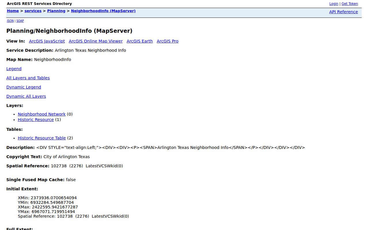
The service view is a useful geographic reference before checking a specific parcel’s separate property record.
Map an Arlington Block Carefully
Follow a short parcel flow instead of broadening a single name search. Begin with the exact street address in CAID or the public map viewer. Confirm the parcel identifier or account before opening a property account. Then look at immediately adjoining parcels one at a time, preserving each record’s owner, situs, and mailing fields as separate facts. Stop at the edge of the immediate block unless there is a clear reason to broaden the search. A full named-street review belongs on the Arlington street directory.
- Find the starting address through the Address tab or a CAID address search.
- Confirm the parcel or tax-account match before copying any owner information.
- Select each adjoining parcel and note its legal description, situs address, owner, and mailing-address role.
- Check the property account when the map needs a record-level confirmation.
- Use precinct, school, or facility layers only as reference context, then verify with the responsible office.
The flow is address to parcel, parcel to owner role, then parcel to adjacent parcel. It does not run from an owner name to a claim that the person is a current neighbor.
Arlington Parcel Fields for Neighbors
Three property fields deserve special care when Arlington neighbors are being researched. The owner field identifies the person or entity shown on the appraisal record. The situs field locates the property. The mailing field identifies where correspondence is sent. Tarrant appraisal data also carries the legal description, which can stabilize the search when a street address is written in more than one format. Read these fields literally and do not convert them into an occupancy claim.
- Parcel
- A defined piece of land recorded and assessed as a property unit.
- Tax account
- The account identifier used to organize an assessed property record.
- Situs address
- The address associated with the physical property location.
- Legal description
- The formal land description that helps distinguish one parcel from another.
CAID’s ZIP field is useful for postal context, but a ZIP code is not a municipal-boundary field. An Arlington mailing address or ZIP may overlap a service area in ways that do not decide city limits, precinct service, or neighborhood association membership.
Arlington Neighborhood Directory Boundaries
The city’s Neighborhood Directory is an opt-in resource. It identifies a neighborhood by name, publishes street boundaries, and provides authorized contacts. It is not a person-by-person resident list. This makes it more useful for finding the right community point of contact than for trying to identify every household near a given address.
Use its boundaries alongside the parcel map, not as a replacement for it. A parcel can be next to a neighborhood boundary without being a member of that organization. An authorized contact also speaks for the group only in the capacity the directory lists. When community information is limited, respect the directory’s scope rather than trying to rebuild a roster from unrelated public records.
Arlington Neighborhood Plans Since 2006
Arlington has adopted nine neighborhood plans since 2006. That count is a useful numbers-based marker for how local planning has been organized over time. The plans explain why a block may appear within a planning area while belonging to a different voluntary neighborhood group. The city’s Neighborhood Plans materials are the place to check the adopted-plan context rather than relying on a map label alone.
Planning areas are public reference geography. They do not prove who lives on a block, who owns a parcel, or whether someone participates in an association. Keep the planning layer with the planning question, and keep owner and contact questions with their proper custodians.
Note: A neighborhood plan can supply local context, while parcel and directory records answer narrower ownership and contact questions.
Community Sources for Arlington Neighbors
Community sources describe how an area organizes itself. They should not be treated as an alternative people list. The Heart of Arlington group focuses around Center and Mesquite north to south and Park Row east to west, near Johnson Creek, downtown, and UTA. Participation is voluntary, annual dues are $10, and meetings are open, while voting and board participation follow the group’s own rules. That is useful context for an Arlington neighbor inquiry focused on community activity rather than private household data.
| Community source | What it can provide | Contact route or limit |
|---|---|---|
| Arlington Neighborhood Directory | Neighborhood name, boundaries and authorized contacts | Use the city’s opt-in directory; it is not a resident roster. |
| Heart of Arlington group | Voluntary neighborhood activity near downtown and UTA | Open meetings; $10 annual dues; voting and board rules remain separate. |
| Arlington Community Watch groups | Resident-organized groups connected with police officers | Group rosters are not published as a general lookup source. |
Arlington Community Watch guidance describes resident-organized groups that connect with officers. Use a public contact route where one is provided. Do not expect or request a complete participant list.
Arlington Precinct Context for 2026
For 2026, use the official voter resource to check precinct-change information connected with a particular voter inquiry. The Texas My Voter Portal uses name, county, date of birth, and ZIP code, then returns eligible registration, VUID, and polling information subject to confidentiality. It does not publish party membership or a block-by-block list of voters. Protected and redacted information stays outside the public result.
| Official record path | Commercial neighbor-tool category | Why the distinction matters |
|---|---|---|
| Names the custodian and the record type | May combine data from unclear sources | Custodian records can be checked at the source. |
| Shows access or confidentiality limits | May not explain removals or redactions | A missing detail should not be guessed or reconstructed. |
| Uses an address, parcel, or identity-specific path | May suggest broad person matches | Parcel roles and current occupancy are different facts. |
Precinct data is civic context, not proof of a person’s party affiliation or a comprehensive household list. Confirm a change with the elections custodian when it affects an important voter question.
Arlington Neighbor Lookup Limits
Some details about a block are deliberately not open. The Texas Address Confidentiality Program supplies a substitute address for qualifying participants. Confidential voter information is protected. Driver information is subject to the Driver’s Privacy Protection Act, and it should not be sought through property or neighborhood tools. Public property data also has a limited meaning: it identifies the record’s owner and address fields, not an unrestricted right to monitor a person’s movements, household, or private communications.
If a record carries a redaction or a directory lacks a contact, leave that boundary in place. The most accurate block picture comes from using each official source for its stated purpose, not from trying to defeat its limits.