
Arlington ZIP Code Directory Coverage
The official Texas geospatial postal-code list, GI-272, supplies the Arlington postal ZIP list below. It identifies codes in an Arlington context, but the inspected source does not give neighborhood coverage or post-office names for each code. Those cells are intentionally marked rather than guessed. Five entries need a live USPS classification check before they are called a PO Box, unique, or special-purpose ZIP.
| ZIP | Areas Covered | Post Office | Notes |
|---|---|---|---|
| 76003 | Arlington context in GI-272 | Not stated in GI-272 | Classification needs live USPS verification. |
| 76004 | Arlington context in GI-272 | Not stated in GI-272 | Classification needs live USPS verification. |
| 76005 | Arlington context in GI-272 | Not stated in GI-272 | Classification needs live USPS verification. |
| 76006 | Arlington context in GI-272 | Not stated in GI-272 | Check an exact address with USPS. |
| 76007 | Arlington context in GI-272 | Not stated in GI-272 | Check an exact address with USPS. |
| 76010 | Arlington context in GI-272 | Not stated in GI-272 | Check an exact address with USPS. |
| 76011 | Arlington context in GI-272 | Not stated in GI-272 | Check an exact address with USPS. |
| 76012 | Arlington context in GI-272 | Not stated in GI-272 | Check an exact address with USPS. |
| 76013 | Arlington context in GI-272 | Not stated in GI-272 | Check an exact address with USPS. |
| 76014 | Arlington context in GI-272 | Not stated in GI-272 | Check an exact address with USPS. |
| 76015 | Arlington context in GI-272 | Not stated in GI-272 | Check an exact address with USPS. |
| 76016 | Arlington context in GI-272 | Not stated in GI-272 | Check an exact address with USPS. |
| 76017 | Arlington context in GI-272 | Not stated in GI-272 | Check an exact address with USPS. |
| 76018 | Arlington context in GI-272 | Not stated in GI-272 | Check an exact address with USPS. |
| 76019 | Arlington context in GI-272 | Not stated in GI-272 | UTA-area association needs USPS confirmation. |
| 76094 | Arlington context in GI-272 | Not stated in GI-272 | Classification needs live USPS verification. |
| 76096 | Arlington context in GI-272 | Not stated in GI-272 | Classification needs live USPS verification. |
Seventeen Arlington ZIP codes appear in GI-272. That number describes the list, not seventeen separate municipal districts or seventeen delivery routes. Postal assignments change and some entries may have a special role, so an exact address check remains necessary.
USPS for Arlington ZIP Codes
USPS ZIP Lookup is the first check for a specific street and unit. It offers By Address, By City and State, and Cities by ZIP modes. The address route takes street, city, and state, with optional company, unit, and ZIP information. Cities by ZIP reverses the question. The tool is valuable for postal formatting, but USPS expressly warns that its result does not prove a person or company is at that address.
| Field or mode | Tool | Best use | Limit |
|---|---|---|---|
| Street, city, state | USPS By Address | Validate a street-format result. | Does not establish title or residence. |
| Company, unit, ZIP | USPS By Address | Add available postal detail to the query. | Optional inputs are not person verification. |
| City and state | USPS By City and State | Find ZIP information from a postal locality. | Postal locality is not a city boundary. |
| ZIP | USPS Cities by ZIP | See the city information USPS returns for a code. | Keep the result with the date checked. |
| Address, owner name, tax account number | Tarrant CAID map | Compare a postal clue with a parcel or map layer. | County maps are general reference. |
Save the postal wording exactly as returned. Then retain the city, county, and record date when moving to a map, appraisal card, deed, or historical directory. That small discipline prevents a modern postal spelling from overwriting the way an older record identified the place.
Arlington ZIP Code Map Layers
The Tarrant Countywide Address Information Database, or CAID, helps compare geographic layers after USPS supplies the postal format. CAID has Main Search, Composite, and Bing Search routes. Tarrant's maps information identifies address, owner name, and tax account number as search paths. Its visible layers include ZIP Codes, Voting Precincts, Schools, property, facilities, city boundaries, flood information, and other civic reference layers.
Use the Tarrant CAID map to visualize the ZIP, precinct, school, and property layers around a verified address.
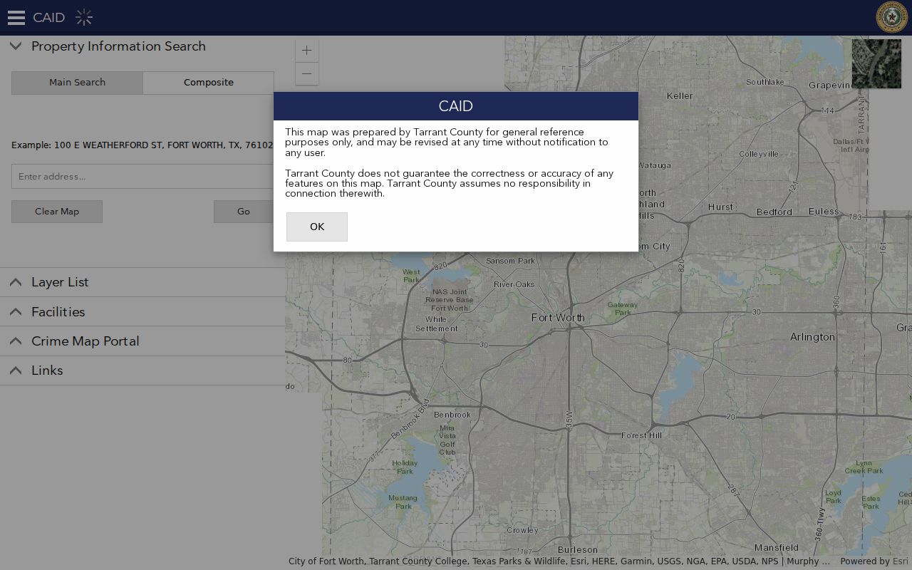
The CAID interface is useful for a visual cross-check, not a final jurisdiction ruling. A ZIP layer, a property layer, and a voting precinct can overlap without being the same boundary. Confirm the needed fact with the appropriate postal, appraisal, elections, or Clerk custodian.
Arlington ZIP Code Search Steps
Finding a person or record from a ZIP begins with an address and proceeds toward the custodian's own identifier. TAD does not use a ZIP as its primary property key. It supplies account, site number, georeference, neighborhood code, legal description, property address, owner field, and primary-owner mailing field. Use a ZIP to narrow geographic context, then use the parcel information to reach property and title material.
- Check the exact street and unit in USPS, and record the returned city and ZIP without treating either as proof of a person.
- Open CAID or the Tarrant GIS Public Map Viewer to compare the ZIP, city boundary, parcel, school, and precinct layers.
- Search TAD Property Search by the returned address or its parcel identifier, and record the legal description and account.
- Use a dated directory, deed index, or tax card only after preserving the original street, city line, and year from the record.
- Ask the postal service, TAD, Elections, County Clerk, or another custodian to resolve a boundary conflict within that office's scope.
Once a ZIP has narrowed the location to a named road, the Arlington street directory provides the address-to-parcel and deed sequence. That later step should still distinguish an owner of record from a listed occupant or other record party.
Arlington ZIP Code Mismatches
A postal city is not a municipality. Arlington-area ZIP maps also involve Fort Worth, Grand Prairie, Mansfield, Kennedale, Dalworthington Gardens, Pantego, and nearby places. A postal label can therefore point beyond the Arlington city limits, while an address near a boundary can need a map check before it is assigned to a city record system. Retain the ZIP, city, county, and geocoder result instead of treating one label as decisive.
A voting precinct is also not a ZIP. The combined Tarrant map can orient a searcher, but voter assignment follows registered-address and precinct rules. TAD can show a mailing ZIP outside Arlington, and that field has a different purpose from a property situs address. Each source should be read within its own role.
Arlington ZIP Code Terms
Postal vocabulary is useful, but it should not be used as a title or residence vocabulary. The definitions below make the common terms clear while keeping the research limit in view: GI-272 did not verify a delivery classification for every Arlington-listed ZIP.
- ZIP Code
- A postal routing code used with an address. It is not a municipal boundary or property identifier.
- ZIP+4
- An added four-digit postal detail used to refine delivery routing for an address or segment.
- PO Box ZIP
- A ZIP used for post-office-box service. Do not apply this label to an Arlington code without current USPS confirmation.
- Unique ZIP
- A ZIP associated with a particular organization or delivery arrangement. Current status requires USPS verification.
- Carrier route
- A postal delivery grouping. It does not show parcel ownership or a complete resident list.
Arlington ZIP Codes and TAD
An Arlington ZIP code can lead to a map area, but TAD provides the better property trail. Its parcel card separates situs address, primary-owner mailing address, legal description, georeference, subdivision, and neighborhood code. An owner correspondence address may be in Grand Prairie or another city even where the property is in Arlington. Capture both fields and label them accurately.
After a parcel is stable, the County Clerk's Official Records Search accepts grantor or grantee, subdivision, document type, and document number, with recorded-date filters and Index Only or Index and Full Text OCR scope. Search subdivision and party terms from the legal description instead of expecting a ZIP code to find every recorded instrument.
Note: ZIP information supplies geographic context, while TAD and the County Clerk keep the parcel and instrument records needed for property research.
Historic Arlington ZIP Code Lines
Older telephone directories and city directories may not use a modern postal convention. The Texas State Library's Arlington holdings have visible gaps, and the UT telephone-directory catalog covers Arlington and nearby communities from 1907 through 2002 with many gaps. Preserve the street, city line, source type, and year exactly as printed before grouping any entries by a current ZIP.
A directory may show a subscriber or listed household at a point in time. A deed identifies a recorded party, while a parcel card supplies current appraisal fields. Compare sources with overlapping dates, and do not convert a historic directory line into a present residence claim. For physical context, the 1917 Sanborn sheets and Arlington newspaper collections can help explain an older block without becoming a person roster.
Arlington ZIP Code Limits
A ZIP result never proves title, current residence, voter status, or a complete connection to an address. Texas Address Confidentiality Program participants use substitute addresses and mail forwarding, and protected voter information is restricted. Utility customer data and DMV address data are not available through a general public-record request. Do not seek to work around those protections.
For lawful personal research, use postal results to check an address, map layers to understand geography, TAD for parcel context, and the County Clerk for recorded instruments. Describe the relationship actually shown by each source, such as owner of record, listed occupant, permittee, or party. Verify important findings with the office that maintains the record.